
To see Global Grade 3's original post, click the link below
Hello Global Grade 3,
I'll start by repeating the wonderful quote from Henry Miller at the beginning of you post...
The moment one gives close attention to any thing, even a blade of grass it becomes a mysterious, awesome, indescribably magnificent world in itself.
~Henry Miller
I saw your post entitled "The Power of Observation and Wonder" and found it very interesting to read. I was going to write a reply because, as the previous Global Grade 3 class knows, I am interested in many things including stones but I have been very busy filming and making DVDs for schools. However, your "A Closer Look at MAPS!" post again caught my attention so I thought I'd write a short post about maps.
I have seen many types of maps including the types you have studied. Perhaps my favourite modern maps are the types I used as a Scout. I would say, "Give me a good map and a compass and I can usually find my way around."
I have scanned an old topographical map I used in the 1970s. It was measured in miles and feet but we were changing over to kilometres and metres around then. Have a look at the map. Click on it to see it larger...
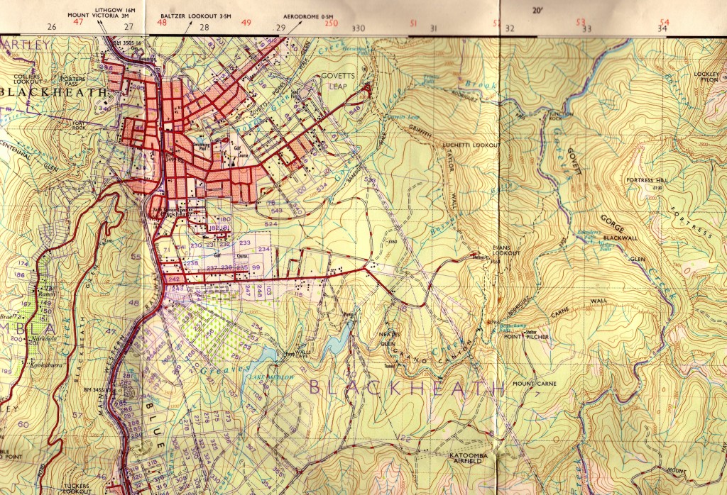
The map has a great deal of information. I can see red lines showing roads. Some roads are shown as white with red dashes to show they are dirt roads. There are thick black lines with small, double dashes along them to show a railway line. Blues lines show rivers and creeks. We can easily see Blackheath is a town but there are large areas without streets and those areas interest me as I have explored those areas.
Can you see the brown wriggly lines on the map?
The brown lines are contour lines. They show heights. Each line shows a height of 50 feet more or less than the next. Some of the lines have numbers such as 3200. The 3200 tells me at that place the land is 3200 feet above sea level. Looking at the numbers and the lines can tell me if I will be going up or down when hiking. Let's look closer at a section of the map...

I have added the red numbers to help students find specific points.
See the black, single dashed lines?
They are walking tracks I have followed. I have walked down from number 1 to 3 and up from 3 to 2.
1 - The beginning of the track is about 3250 feet above sea level.
2 - The end of the dirt road is about 3200 feet above sea level
3 - Beachamp Falls is about 2650 feet above sea level.
The map shows me if I walk down from 1 to 3, I will drop 600 feet. If I then walk up to 2, I will go up 550 feet. Because the brown lines are close together, I know the track will be steep in places.
Do you notice one section is named Grand Canyon?
It's not even close to the size of the Grand Canyon in U.S.A. but it is steep sided.
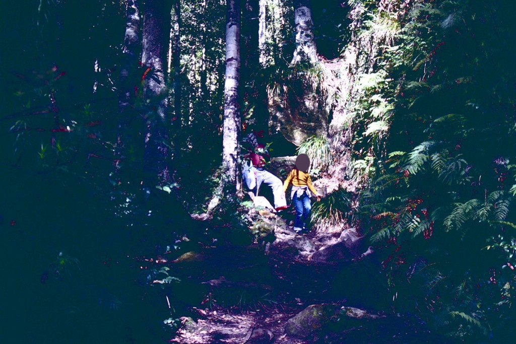
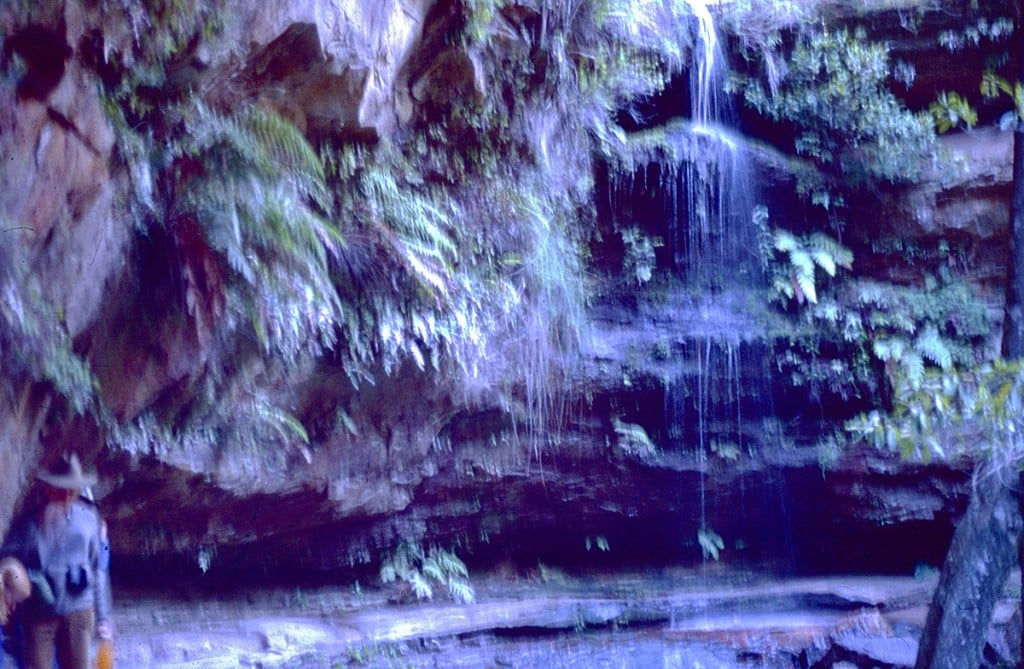
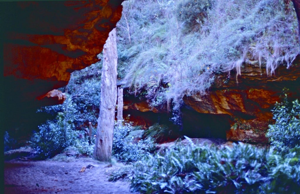
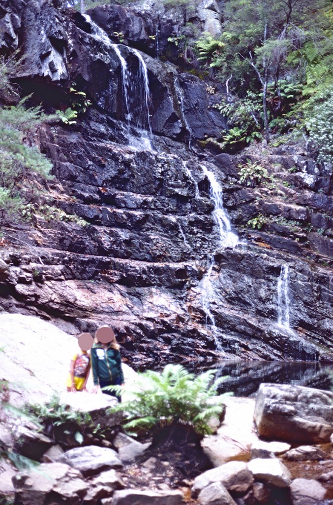
Let's look at some photos I had taken around 1980 in the Grand Canyon and at Beauchamp Falls.
Starting down the steep track from 1.
We pass through a small tunnel and behind waterfalls.
Deep down in the Grand Canyon.
Until we reach Beauchamp Falls at 3.
And now for two photos for your "The Power of Observation and Wonder" post. The photos show rocks that caught my eye but were left in place. They were in a national park so we are not allowed to take them. They were also far too big to carry.
The first shows a large sandstone rock.
Can you see the black mark?
It is the remains of a tree trunk buried under sand millions of years ago but now exposed after a rock fall. It is a fossil record of the tree.

The second shows an even larger sandstone rock.
Do you notice the ripples on it?
Millions of years ago sand was rippled by flowing water. A thin layer of mud covered the ripples and in time left a fossil record of water running over sand.
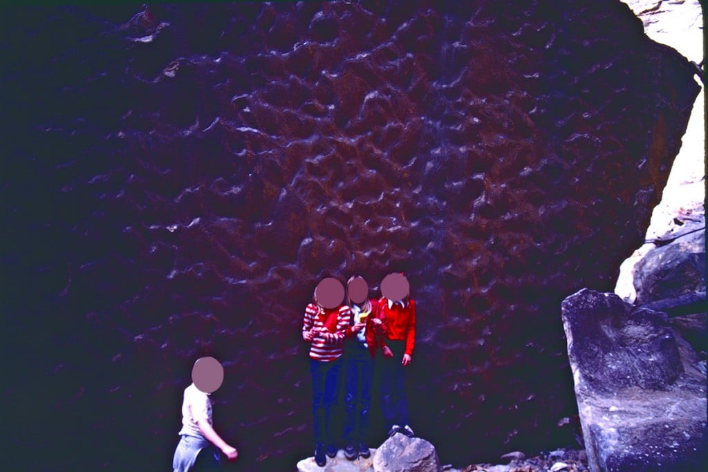
What is even more amazing is this sandstone was sand under the sea millions of years ago but it is now lying 2650 feet above sea level. These rocks of sandstone certainly caught my eye and the eyes of the children I had taken there as we thought of their long history.
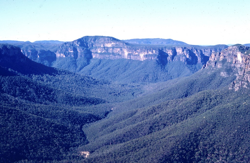
When we then walk the 550 feet in height (but much longer along track) back up to 2, this is what we see when looking north.
...and now your interesting questions...
How long does it take to study a place and then make the map?
For early map makers, they might have to walk, ride or travel by ship in order to make maps so it could take a long time to make a map.
Back in August 1768, Captain James Cook set sail from England. He was taking scientists to Tahiti to observe Venus crossing the Sun. Once the scentists had finished their observations, Cook's orders were to sail south to find Terra Australis Incognita, the unknown southern land, some people thought must exist.
In September, 1769 he reached New Zealand and set about mapping its islands.
In April 1770, he reached a land he named New South Wales. It was really the east coast of Australia. He sailed north along the coast mapping as he went. Cook and his ship didn't return to England until 12th July, 1771. It had taken him and his crew three years to make the journey and return with the maps he had made.
Today, with satellites, GPS and Google Earth, we can map the world from our own homes.
How many different kinds of maps are there?
Interesting question and makes me wonder what a map might be. We know most types but is a plan for a house a map? Is a design for a new machine a map? They also show where things are.
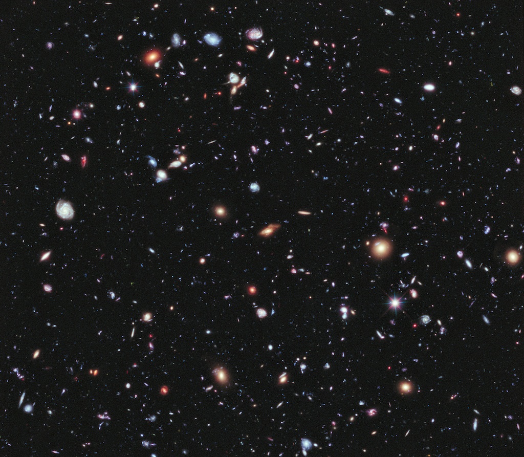
Are there maps about SPACE?
Now this is complicated. In your post , you noticed the maps you saw were two dimensional flat maps. In order to find a place on a map, you needed to know how far up or down and side to side a place is.
To accurately map space, we would need a three dimensional map and it would have to be huge because space is huge. Using computer models, there are space maps. Here is a link to a 3D space map animation representing 400,000 galaxies. Remember our Sun is just one star amongst possibly hundreds of billions in just one of those galaxies.
Amazing Universe Fly-Through
How do pilots use maps?
Have a look at this aviator's map. It's how a pilot might plot a course using information on their computer.
SkyVector Areonautical Maps
Of course, pilots in early days didn't have computers. They would look down to the ground and possibly follow roads or railways to their destination or they might use a compass so an old fashioned paper might might have helped.
Do we have maps for EVERYTHING?
WOW! Maps of everything? Even on our own Earth there are places no one has ever been so, for example, there are no accurate maps for some of the deepest places in our oceans. What about other planets, stars, galaxies? We may not have maps for everything but we do have maps of very many things but there is still so much more waiting for someone like you to map.
What jobs need maps?
Cartographers (map makers), pilots, sailors, explorers, delivery drivers, police, ambulance, fire fighters, tow truck drivers... There would be so many jobs where we might need maps at some time.
How old is the OLDEST map?
A link if you want to see old maps.... Early World Maps
Look at these three maps...

The first shows the world as known by the Greeks perhaps 3000 years ago. It shows the Mediterranean Sea.
The 500 BC map from around 2500 years ago shows the Red Sea and the opening into the Atlantic Ocean.
By 150 AD Europe, parts of Africa, and Asia has appeared on the maps. Notice Terra Incognita at the bottom right of the map. It's what Captain Cook was sent to find or show wasn't there.
How many countries are there in the world?
Interesting... The United Nations has 193 countries as members. My blog has had visits from 193 countries and I have seen 196 listed as the number of independent countries in the world. Here is a link for you...
The Number of Countries in the World
Do maps ever change? (This one brought up some VERY interesting conversations around Bombay, Calgary, Nunavut and the NEW islands that VOLCANOES create!!!)
Maps have to change when what has been mapped changes.
Yes, volcanoes can create new islands.
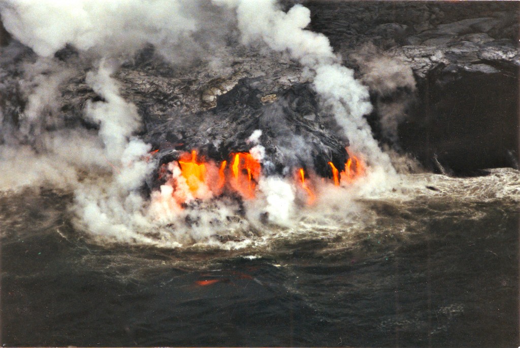
You know about the big island of Hawaii. Did you know deep under the ocean around 30 kilometres south of The Big Ilsand there is a new volcano rising around 10,000 feet from the ocean floor with only about 3100 feet before it reaches the surface? If in the future it does break the surface, Hawaii will have a new Island.
The islands of Hawaii were formed in this way and will eventually erode into the ocean as many have already done over millions of years. Look at the Google Earth image below. The Hawaiian Islands are in the middle at the bottom. Look carefully and you can seen now submerged volcanoes moving off to the left as you go north. They may once have been islands as is Hawaii.
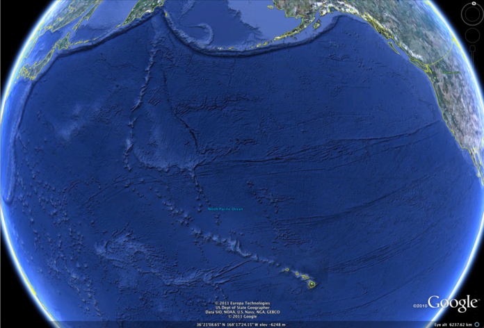


 Schools and students have permission to use this graphic for non-commercial, educational purposes.


