Tag Archives: The Outback

2 Comments

To visit the original blog, click on Rocky River Goes Global

This is the 199th post on this blog. Rocky River, check out post number 201...

Post 201: About  Bilbies and 200 posts

Hello Rocky River, here is the second part of a post I promised. This time we will look at life in a small, isolated school serving sheep and cattle stations, School of the Air, cattle stations in the Outback and life on a large sheep station.

Schools of the Air

By Premier's Department, State Public Relations Bureau, Photographic Unit [Public domain], via Wikimedia Commons

By Queensland Premier's Department, State Public Relations Bureau, Photographic Unit [Public domain], via Wikimedia Commons 1960

Because of the isolated locations of some children on sheep and cattle properties or in communities too small for a school around Australia, a number of schools were set up to allow children to use two way radio. The first radio broadcasts dated back to 1951 and were sent out from the Royal Flying Doctors Service in Alice Springs. From 2003 till 2009, short wave radio was used but schools of the air are now turnng to internet technology giving students better access to information and the world.

In earlier years, radio became a contact to the world for isolated people. They used radios which were pedal powered. Someone would pedal to make electricity from a generator in order to power their radio.


Sourced through Wikimedia Commons - This image is of Australian origin and is now in the public domain because its term of copyright has expired. According to the Australian Copyright Council (ACC), ACC Information Sheet G023v16 (Duration of copyright) (Feb 2012).

Sourced through Wikimedia Commons - This image is of Australian origin and is now in the public domain because its term of copyright has expired. According to the Australian Copyright Council (ACC), ACC Information Sheet G023v16 (Duration of copyright) (Feb 2012).

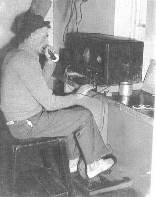
With modern technology, you would find it much easier to use solar energy for electricity.

There are now a number of locations for Schools of the Air around Australia. According to Wikipedia, the schools of the air are in the towns of...

 School of the Air Locations

Schools and students have permission to use this graphic for non-commercial, educational purposes.

Schools and students have permission to use this graphic for non-commercial, educational purposes.

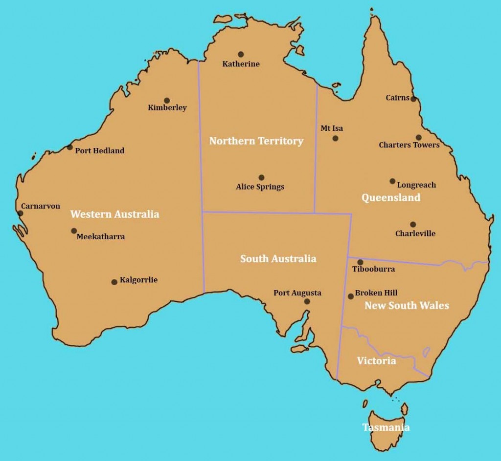
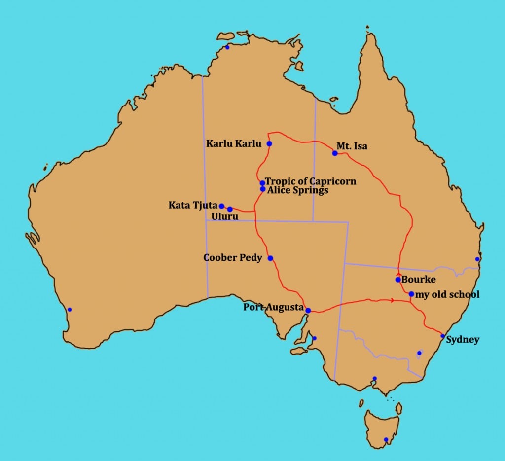
Within my state of New South Wales, the most isolated school is listed as Tibooburra School of the Air. The school is based in the town of Tibooburra. The school where I first had a permanent teaching position wasn't a school of the air although some high school students in my area used correspondence school where lessons were sent by mail. My school, Marra Creek Public School, was the sixth most isolated school in my state and the first not to be located in a town.

Marra Creek Public School

This was the first school were I was a permanent teacher and it was considered the sixth most isolated school in New South Wales. The five more isolated, while further from the state capital of Sydney, were in towns. Marra Creek Public School was 100km (62mi) from the nearest town. The children lived on sheep and cattle stations around the school and could travel from up to 50km (31mi) to school each day. Because the outback refers to isolated and remote areas, it could be considered an outback school. If you click on the school website link above, you will see they list themselves as an outback school.

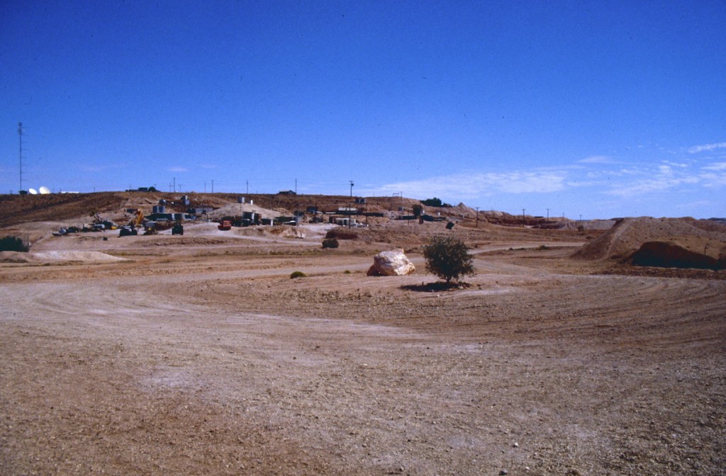
This section of the blog post looks at my time in this outback school in the early 1980s.

Schools and students have permission to use this graphic for non-commercial, educational purposes.

Schools and students have permission to use this graphic for non-commercial, educational purposes.

When I first arrived at the school, the above photo shows what I found. You can see it had tanks to catch rain falling on the roof if it rained and a toilet block near the school building. We had a flagpole and a tall TV antenna but we could only receive one TV channel if the weather conditions were good.

Schools and students have permission to use this graphic for non-commercial, educational purposes.

Schools and students have permission to use this graphic for non-commercial, educational purposes.

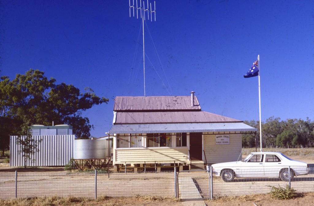
The playground was mostly dirt but there was some ground covering plants. You couldn't go barefoot because there were often nasty wooden thorns called catheads. They would always have one spike pointing up.

Phone winding

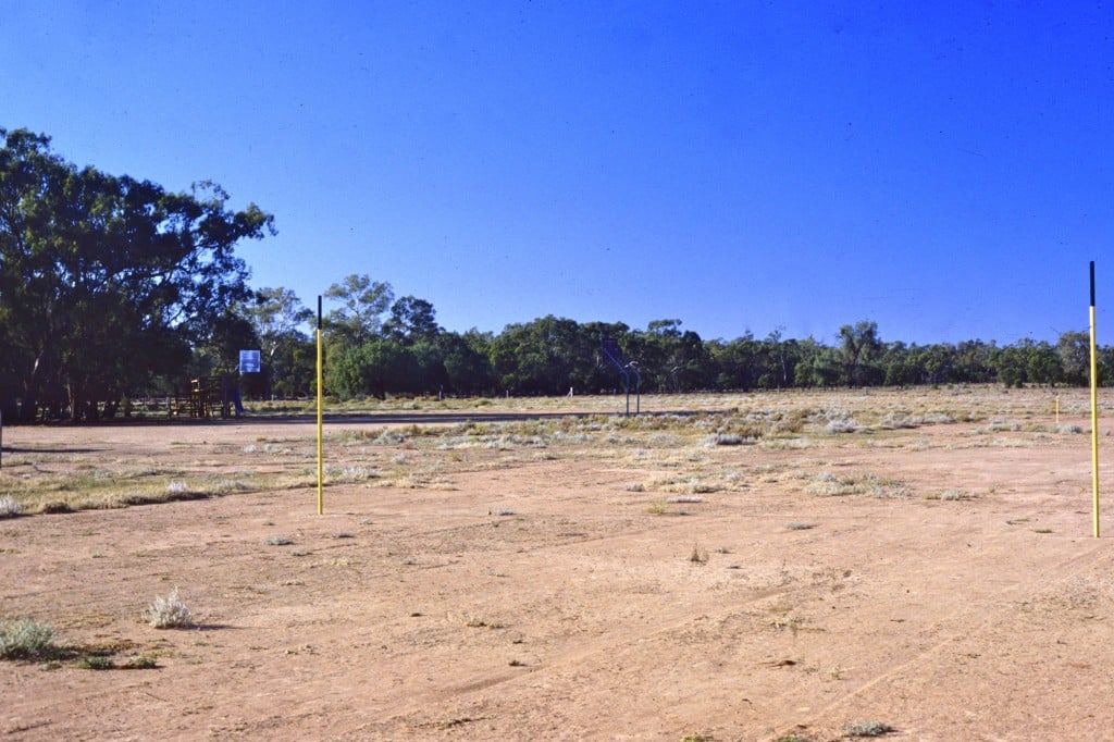
We had a phone where, if you wanted to make a phone call, you would pick up the handset and listen to make certain no one else was using it. You would then put the handset down, wind a handle, then pick the handset up to see if the operator had answered. You could then ask for a number.

We didn't have mobile phones, push button numbers, emails, CDs, DVDs, Bluray or the internet back then but, for 6 weeks each year, we were able to use a borrowed Apple II computer. The computer had only about 12 programs so I wrote some extras for the class to use. Luckily for the children, I had used computers while a university student in the 1970s.

It was back in 1982 I purchased my first personal video camera. They were new on the market and expensive. When I used it, some people thought I might be from a television station. Using it, I produced my first school video clip. Now converted from VHS video tape to digital, below is a section of that first video clip. The youngest children, 5 years old, in the video would now be about 37 years old. I have never before shared this video clip with others since I was in that school so this is a special share for you to see outback children at work and play in the 1980s..

You Tube has removed some copyrighted music I used back then. I try to make certain video clips I now make only have music I am allowed to use.

During my two years at the school, numbers ranged from 12 to 20 students aged from 5 to 13 all in the one small classroom. I was the only teacher and was known as the Teacher In Charge (not a principal).

With a new classroom and my old classroom now the library, a teacher house and access to the internet, the school would be very different compared to when I taught there but it is still about 100km from the nearest town and so is still an outback, isolated school.

Sheep Stations

While teaching at Marra Creek Public School, I lived "next door" to the school about 20km (12mi) distant by road. I stayed in a house on a sheep station known as Lemon Grove. While I has there, the property grew to about 400 square kilometres (100,000 acres) although at the time the video clip below was made, the property was half that size. A neighbouring property had been bought by the end of 1982.

Below is a video clip I again made in 1982. It features Lemon Grove stud (sheep breeding property) and its annual field day. The field day allowed Lemon Grove and neighbouring properties to sell their sheep. It was also a social event for the area.

For any outback property, reliable water supplies can be a problem. Many properties have to pump water from natural underground sources such as the Great Artesian Basin found under about one quarter of Australia although water from the Basin came come to the surface by itself  (see the grey shaded area on the map below).

Schools and students have permission to use this graphic for non-commercial, educational purposes.

Schools and students have permission to use this graphic for non-commercial, educational purposes.

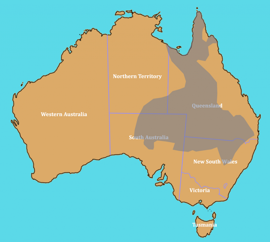
On many farms, and sheep and cattle stations, you will see windmills. The windmills use wind power to pump water up from underground. Lemon Grove had a windmill near the main houses.

Schools and students have permission to use this graphic for non-commercial, educational purposes.

Schools and students have permission to use this graphic for non-commercial, educational purposes.

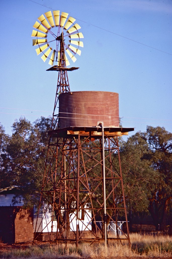
Each year, the sheep on Lemon Grove would be brought in for shearing in the shearing shed.

Schools and students have permission to use this graphic for non-commercial, educational purposes.

Schools and students have permission to use this graphic for non-commercial, educational purposes.

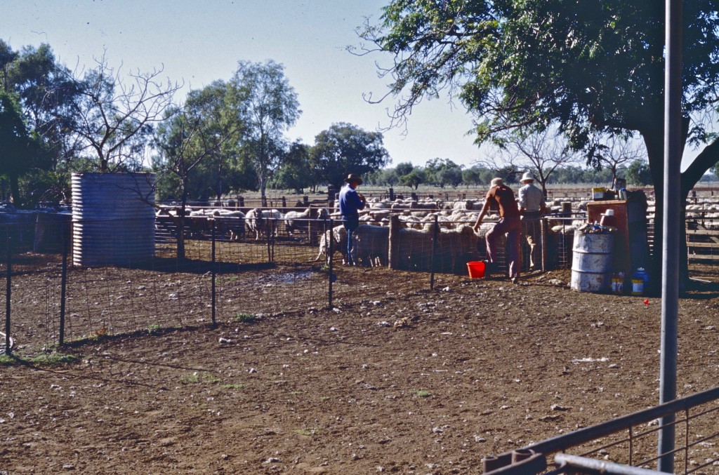
Shearers take the sheep and shear off the fleece in one piece.

Schools and students have permission to use this graphic for non-commercial, educational purposes.

Schools and students have permission to use this graphic for non-commercial, educational purposes.

Once done, the shearer takes the next sheep while others collect the fleece and take it to a table where bits of plants or dirt can be removed. A woolclasser then checks the quality of the fleece. They check how fine the wool is. Merino wool from these sheep is amongst the finest wool in the world.

Schools and students have permission to use this graphic for non-commercial, educational purposes.

Schools and students have permission to use this graphic for non-commercial, educational purposes.

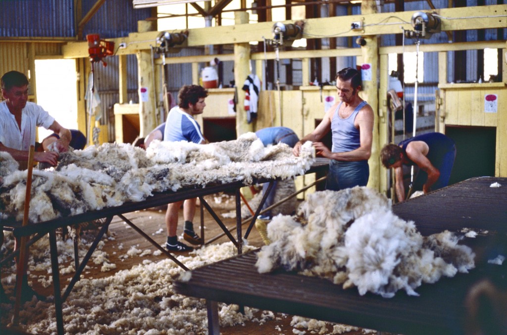
Once classed, the fleece is put into a press with the same quality wool. When full, the press forces the wool together into bales. Bales can then be placed on trucks and sent off for sale.

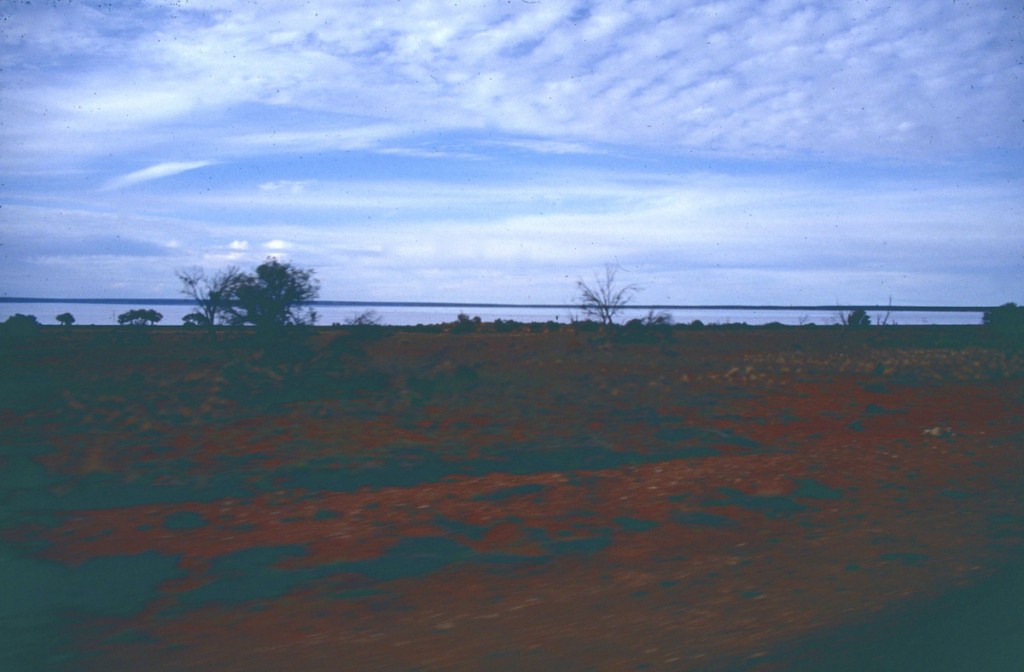
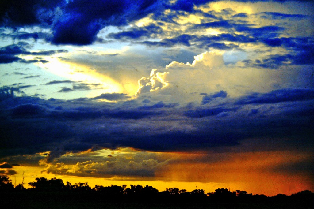
Sunsets at Lemon Grove could sometimes be amazing, especially when storm clouds were gathering.

Schools and students have permission to use this graphic for non-commercial, educational purposes.

Schools and students have permission to use this graphic for non-commercial, educational purposes.

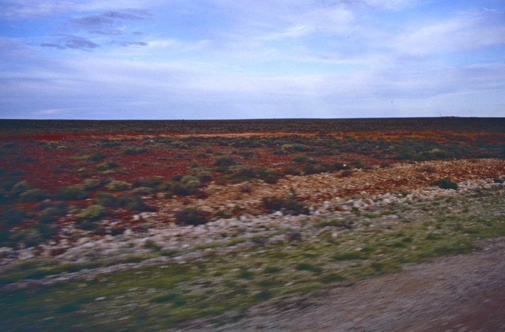
Sometimes, the miracle of rain comes to the dry land and within two weeks, the land can turn green with plant growth.

Schools and students have permission to use this graphic for non-commercial, educational purposes.

Schools and students have permission to use this graphic for non-commercial, educational purposes.

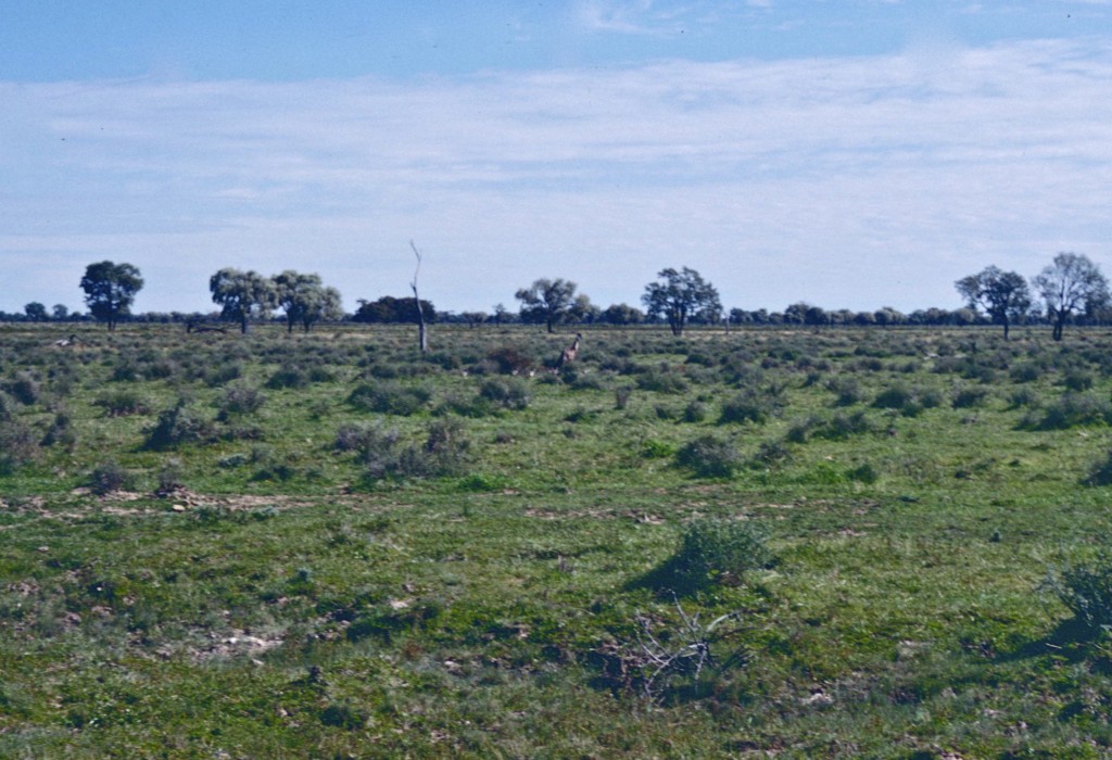
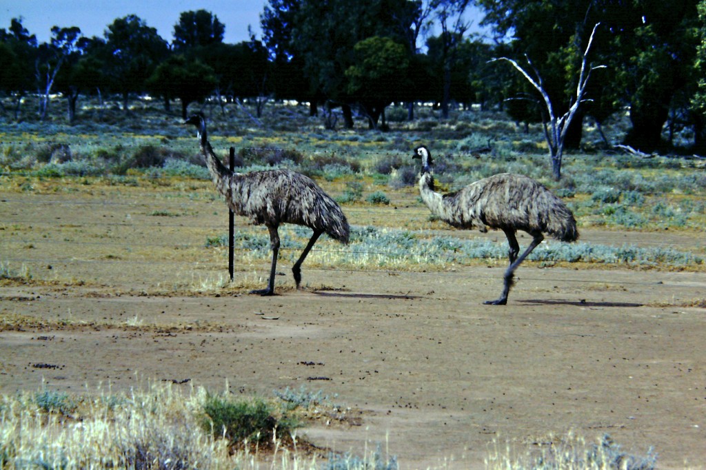
If you look very carefully in the middle of this photo, you can see an emu running away from where I was standing. Like ostriches, they can't fly. They rely on running to escape danger.

It is a male. How do I know? Look even more carefully and you can see chicks following the emu. For emus, once the female has laid the eggs she leaves. It's the males that care for the eggs and developing chicks.


Schools and students have permission to use this graphic for non-commercial, educational purposes.

Schools and students have permission to use this graphic for non-commercial, educational purposes.

CATTLE STATIONS

Cattle stations mixed with sheep stations are found near Marra Creek School but, as you move into northern and more western Australia, sheep give way to cattle. Australia's largest cattle station is known as Anna Creek Station.

Anna Creek Station is roughly 24,000 square kilometres (6,000,000 acres or 9,400 sq mi) or about the size of the U.S.A. state of New Hampshire. It is in the state of South Australia. The largest cattle ranch in the U.S. is, I think, King Ranch in Texas.  At 3,340 square kilometres (825,000 acres or 1289 sq mi) you would need a little over 7 King Ranch to make up Anna Creek Station.

In areas where rainfall is low, stations need to be very large to allow enough land for cattle to feed. In the photo below, taken by Robert Kerton of the Commonwealth Scientific and Industrial Research Organisation (CSIRO) in the Northern Territory, you can see how arid cattle station land can be.

This image is a CSIRO Science Image taken by Robert Kerton. It was sourced through Wikimedia Commons. http://commons.wikimedia.org/wiki/File:CSIRO_ScienceImage_1672_Cattle_in_dry_landscape.jpg

This image is a CSIRO Science Image taken by Robert Kerton. It was sourced through Wikimedia Commons. This photo was taken in the Northern Territory in NOvember, 1989. http://commons.wikimedia.org/wiki/File:CSIRO_ScienceImage_1672_Cattle_in_dry_landscape.jpg

Anna Creek Station in South Australia is roughly 24,000 square kilometres (6,000,000 acres or 9,400 sq mi) and, as at 2012, it had 17,000 cattle. That means each animal has about 1.4 square kilometres (353 acres or about half a sq mi). Smaller stations where more feed and water is available would have higher numbers of cattle for the land available.

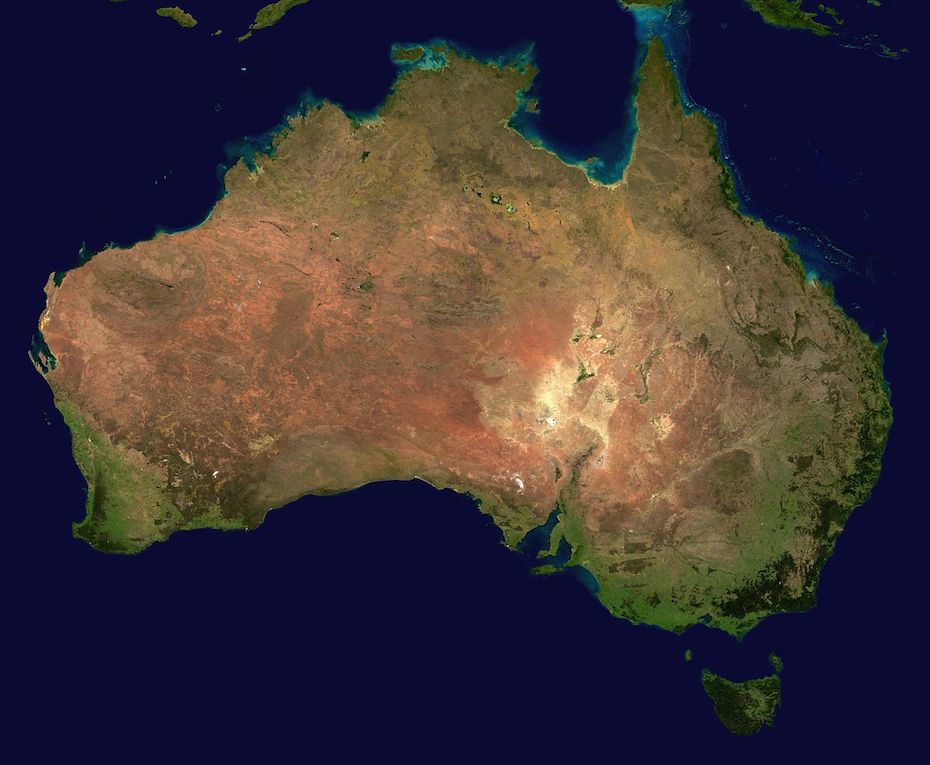
Australia is a huge country, although smaller than U.S.A.'s 50 states yet most of it is arid or semi-arid (desert or near desert). Most Australians live around the coastal areas, paricularly in the east of Australia.

Sheep and Cattle Where I Live

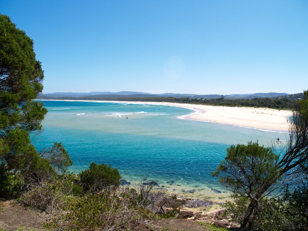
My home is along Australia's east coast about half way between Sydney and Melbourne. It is in the Bega Valley Shire, an area known for Bega Cheese and its beautful coastline is popular with tourists. My family has been in this area since the 1840s. They were, and my cousin still is, dairy farmers. As well as dairy, we have beef cattle and sheep in my area. A few properties also have alpacas, none of these animals being native to Australia.

Below is a photo taken on the old family farm...

Schools and students have permission to use this graphic for non-commercial, educational purposes.

Schools and students have permission to use this graphic for non-commercial, educational purposes.

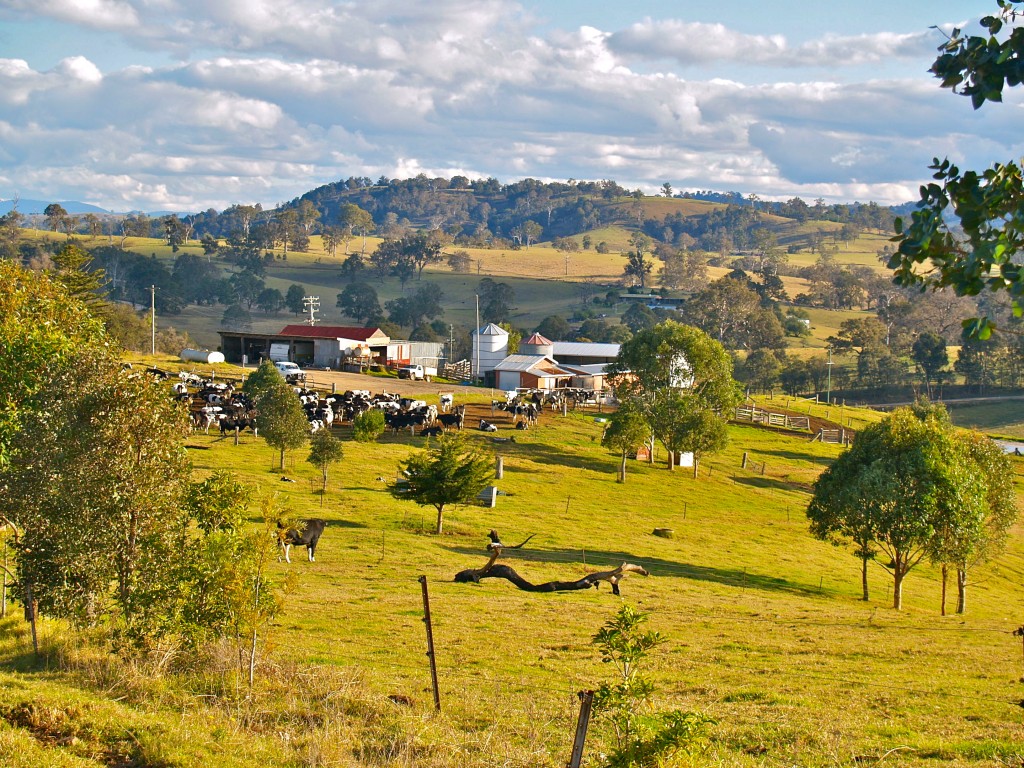
You can see it is much greener and hillier than central Australia. Farms are much smaller than the sheep and cattle stations of the Outback.

...and since I mentioned our coastline, here is a photo I have taken of the coastline as can be seen from my town.

Schools and students have permission to use this graphic for non-commercial, educational purposes.

Schools and students have permission to use this graphic for non-commercial, educational purposes.


5 Comments

Mrs. Todd and her Roadrunners are looking at Outback Australia. This is a post about an Outback journey I organised for parents and children from a school back in 1985. It's hard to believe those students would now be about 40 years old.

In this post, some video clips I had taken back in 1985 as my group travelled to Uluru and back have been shared. They have been converted from VHS tapes to digital and are being shared for the first time. 

The Australian Outback

I don't know exactly where The Outback is said to start but I've always understood it to be the more isolated, arid (desert-like) areas across the centre of Australia. Most Australians live in coastal areas although there are larger communities in some Outback areas including traditional land owners, miners and graziers (cattle ranchers).

Let's look at a satellite photo of Australia Wikimedia lists as NASA sourced and in the public domain...

This image was sourced through Wikimedia Commons where it has bee sourced from NASA and is listed in the public domain. http://commons.wikimedia.org/wiki/File:Australia_satellite_plane.jpg

This image was sourced through Wikimedia Commons where it has bee sourced from NASA and is listed in the public domain. http://commons.wikimedia.org/wiki/File:Australia_satellite_plane.jpg

If you look at this photo you can see green areas are mostly coastal whereas from the west (left on the photo) to most of the way east you see reds, browns and even white. The white areas, especially the very white areas are not snow. They tend to be salt lakes and high salt areas only filling with water when there are very heavy rains in Queensland. Once the water reaches the lakes, it has nowhere to go as the lakes lie below sea level. The water evaporates and leaves the salt behind.

Let's look at the journey my group took back in 1985. I was the tour organiser and minibus driver on our two week, 7000+km (4350+mi) journey into The Outback and back .


Schools and students have permission to use this graphic for non-commercial, educational purposes.

Schools and students have permission to use this graphic for non-commercial, educational purposes.

We started out in Sydney, the capital of the state on New South Wales and headed west then turned north to spend our first night in an isolated school where I had worked in the early 80s.

The school, Marra Creek Public School, is about 670km (415mi) from Sydney and lies 100km (62mi) from the nearest town of Nyngan. It served children from local sheep and cattle properties. I stayed at a neighbouring shearer's house about 20km (13mi) from the school.

Schools and students have permission to use this graphic for non-commercial, educational purposes.

Schools and students have permission to use this graphic for non-commercial, educational purposes.

Was the school in The Outback? It was isolated, used water from tanks, had a phone where you had to talk to an operator to be connected, and only sometimes could pick up one television station if the conditions were good. I sometimes had to chase emus and kangaroos or even wild pigs out of the playground.

Schools and students have permission to use this graphic for non-commercial, educational purposes.

Schools and students have permission to use this graphic for non-commercial, educational purposes.

A video clip of emus in an animal sanctuary close to my home.


And some kangaroos from the same sanctuary.


When I first started there we had been in drought and the water tanks were low, temperatures at times reached 47C (116F). With rains, the clay pans turned green with grass and roads became muddy. We didn't have snow days but we did have mud days when half of the students couldn't make it along the dirt roads. We didn't build mud men. Snow seems to work better and is cleaner.

Heading across country, we visited the town of Bourke most would consider an outback town. It lies along the Darling River, a river sometimes drying out if rains don't fall in Queensland and can also flood when heavy rainfall comes. On our trip, rainfall in the outback had been unusually good but still low compared to coastal.

Schools and students have permission to use this graphic for non-commercial, educational purposes.

Schools and students have permission to use this graphic for non-commercial, educational purposes.

Not too far north of Bourke, we crossed into the state of Queensland. You can see in the photo below just how flat and semi-arid (almost desert) much of inland Australia can be.

Schools and students have permission to use this graphic for non-commercial, educational purposes.

Schools and students have permission to use this graphic for non-commercial, educational purposes.

Heading north, we were heading towards the town of Longreach. The landscape had dried out.

Schools and students have permission to use this graphic for non-commercial, educational purposes.

Schools and students have permission to use this graphic for non-commercial, educational purposes.

Stopping for the night, we were entertained by brolgas, the only cranes native to Australia. While at Marra Creek Public School, I had watched brolgas "dancing" their mating dance as they made jumps into the air.

Schools and students have permission to use this graphic for non-commercial, educational purposes.

Schools and students have permission to use this graphic for non-commercial, educational purposes.

The video clip below isn't one of mine but shows the dance of the brolgas.

Just north of Longreach, we crossed the Tropic of Capricorn. This means we were now in the tropical region of the world.

Near Longreach we saw an echidna on the side of the road. Echidnas and the platypus are the world's only living mammals that lay eggs but, as they are mammals, the mothers can give milk to their young. Echidnas are also found around my town and have sometimes visited my garden in search of ants.

Schools and students have permission to use this graphic for non-commercial, educational purposes.

Schools and students have permission to use this graphic for non-commercial, educational purposes.

Below is a video of an echidna taken at an animal sanctuary near my home.

Our next major settlement was Mount Isa (pictured below), a mining town in western Queensland. Lead, silver, copper and zinc are mined in the Mount Isa area.

Schools and students have permission to use this graphic for non-commercial, educational purposes.

You can easily see the red of the soil, a soil colour so common in The Outback.

From Mt. Isa, we head west to the border with Northern Territory. The photo below was taken standing in the state of Northern Territory looking into Queensland.

Schools and students have permission to use this graphic for non-commercial, educational purposes.

Schools and students have permission to use this graphic for non-commercial, educational purposes.

Reaching the Stuart Highway, a highway running from Adelaide, the capital of the state of South Australia, in the south to Darwin, Northern Territory's capital, in the north, we took a left turn because we had reached as far north as we were going on this journey.

Passing through the town of Tennant Creek,  our next major attraction was Karlu Karlu (known also as the Devil's Marbles) 105km (65mi) south of Tennant Creek. Here are some photos taken at Karlu Karlu.

Schools and students have permission to use this graphic for non-commercial, educational purposes.

Schools and students have permission to use this graphic for non-commercial, educational purposes.

Schools and students have permission to use this graphic for non-commercial, educational purposes.

Schools and students have permission to use this graphic for non-commercial, educational purposes.

That's not me pretending to hold up the rock.

The video clip below was taken on the 1985 trip and has been converted to digital and shared for the first time.

Karlu Karlu is a sacred site to the Alyawarre (Aboriginal) whose country includes the site. It's also sacred to the Kaytetye, Warumungu and Warlpiri people. There are a number of traditional Dreaming stories for the Karlu Karlu area but only a few are able to be shared with uninitiated people such as us.

From Karlu Karlu, we continued south towards Alice Springs. As we travelled, we again crossed the Tropic of Capricorn, this time heading out of the tropics. Someone with a sense of humour had painted words on the road (not us).

Schools and students have permission to use this graphic for non-commercial, educational purposes.

Schools and students have permission to use this graphic for non-commercial, educational purposes.

Schools and students have permission to use this graphic for non-commercial, educational purposes.

Schools and students have permission to use this graphic for non-commercial, educational purposes.

Alice Springs is the largest town in Central Australia and the third largest in Northern Territory. Central Australia is only a name for the area and is not a state. To the local people, the Arrernte, the Alice Springs area is known as Mparntwe.

On our visit, we managed to see a rare rainbow over Alice Springs.

Schools and students have permission to use this graphic for non-commercial, educational purposes.

Schools and students have permission to use this graphic for non-commercial, educational purposes.

Alice Springs lies within the MacDonnell Ranges. There are so many beautiful places to visit in this arid area. Here are just two...

Standley Chasm

Schools and students have permission to use this graphic for non-commercial, educational purposes.

Schools and students have permission to use this graphic for non-commercial, educational purposes.

The video clip of Standley Chasm below was taken on the 1985 trip and has been converted to digital and shared for the first time.


Simpsons Gap (it was late in the day)

Schools and students have permission to use this graphic for non-commercial, educational purposes.

Schools and students have permission to use this graphic for non-commercial, educational purposes.

The video clip of Simpsons Gap below was taken on the 1985 trip and has been converted to digital and shared for the first time.

The video clip of black-footed rock wallabies below was taken on the 1985 trip and has been converted to digital and shared for the first time. The rock wallabies were our companions as we explored Simpsons Gap.

After leaving Alice Springs, we took time for a camel ride. Camels aren't native to Australia but were brought here by Afghan camel herders in the 1800s. Before roads and railways, all supplies had to be brought in by camel trains. When road and rail arrived, many camels were released into the wild. Australia now is the country with the largest number of wild camels in the world and at times exports camels back to the Middle East.

Schools and students have permission to use this graphic for non-commercial, educational purposes.

Schools and students have permission to use this graphic for non-commercial, educational purposes.

The video clip of camel riding below was taken on the 1985 trip and has been converted to digital and shared for the first time.

We were heading to Uluru and Kata Tjuta. Along the arid way, we saw Mount Conner standing high above the desert.

Schools and students have permission to use this graphic for non-commercial, educational purposes.

Schools and students have permission to use this graphic for non-commercial, educational purposes.

Tourists to Central Australia shouldn't miss a chance to see  Uluru and Kata Tjuta. Here are some photos I had taken.

Uluru (aka Ayers Rock) at sunset

Schools and students have permission to use this graphic for non-commercial, educational purposes.

Schools and students have permission to use this graphic for non-commercial, educational purposes.

Uluru (aka Ayers Rock) at sunset

Schools and students have permission to use this graphic for non-commercial, educational purposes.

Schools and students have permission to use this graphic for non-commercial, educational purposes.

Uluru (aka Ayers Rock) up close

You can get an idea of its size by looking at the people climbing it.

Schools and students have permission to use this graphic for non-commercial, educational purposes.

Schools and students have permission to use this graphic for non-commercial, educational purposes.

And a view from almost the top of Uluru

Schools and students have permission to use this graphic for non-commercial, educational purposes.

Schools and students have permission to use this graphic for non-commercial, educational purposes.

Since my visit 30 years ago, visitors have become much more aware of the importance of Uluru to the local people. While they don't stop visitors climbing the rock, many visitors now choose not to climb in respect for the beliefs of the local people.

The video clip of an Uluru sunset below was taken on the 1985 trip and has been converted to digital and shared for the first time. It is running at 20x normal speed.

Around the base of Uluru, there are many sacred sites we are asked to respect. Some are sacred men's sites and some sacred women's sites.

Schools and students have permission to use this graphic for non-commercial, educational purposes.

Schools and students have permission to use this graphic for non-commercial, educational purposes.

However, there are sites visitors can see. Here is a photo taken at one such site, Mutitjula (Maggie Springs). You can see some of the rock paintings.

Schools and students have permission to use this graphic for non-commercial, educational purposes.

Schools and students have permission to use this graphic for non-commercial, educational purposes.

From Uluru, it is possible to see the distant Kata Tjuta rising from the desert plain.

Schools and students have permission to use this graphic for non-commercial, educational purposes.

Schools and students have permission to use this graphic for non-commercial, educational purposes.

Back in our mini-bus, we headed along the dirt road to Kata Tjuta.

Schools and students have permission to use this graphic for non-commercial, educational purposes.

Schools and students have permission to use this graphic for non-commercial, educational purposes.


Schools and students have permission to use this graphic for non-commercial, educational purposes.

Schools and students have permission to use this graphic for non-commercial, educational purposes.

On leaving Uluru and Kata Tjuta, we rejoined the Stuart Highway and again headed south crossing the state border into South Australia.

Schools and students have permission to use this graphic for non-commercial, educational purposes.

Schools and students have permission to use this graphic for non-commercial, educational purposes.

Our next stop would be Coober Pedy, famous for its opal mined in the area. Because of the high temperatures on summer days, some homes in Coober Pedy have been built underground.

Schools and students have permission to use this graphic for non-commercial, educational purposes.

Schools and students have permission to use this graphic for non-commercial, educational purposes.

Heading further south, we started to see salt lakes near the road. As they are lower than the distant sea, water entering can't flow out. The water evaporates and leaves the salt behind. You can see a late afternoon photo of a salt lake.

Schools and students have permission to use this graphic for non-commercial, educational purposes.

Schools and students have permission to use this graphic for non-commercial, educational purposes.

There were many kilometres of flat roads as we continued south.

Schools and students have permission to use this graphic for non-commercial, educational purposes.

Schools and students have permission to use this graphic for non-commercial, educational purposes.

On reaching Port Augusta in South Australia, we headed east and back to Sydney. We had travelled over 7000+km (4350+mi) in our journey through The Outback.